كتب علاء خلاف
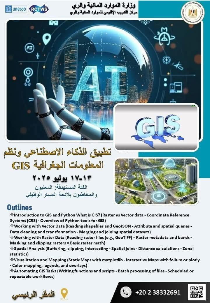
يعلن مركز التدريب الإقليمي للموارد المائية والري عن عقد البرنامج التدريبى “تطبيقات الذكاء الاصطناعي ونظم المعلومات الجغرافية GIS”، وذلك خلال الفترة من ١٣-١٧ يوليو ٢٠٢٥ بالمقر الرئيسى لمركز التدريب بمدينة ٦ أكتوبر
وتتضمن محاور البرنامج :
❇️ Introduction to GIS and Python-What is GIS? (Raster vs Vector data – Coordinate Reference Systems (CRS) – Overview of Python tools for GIS)
❇️ Working with Vector Data-Reading shapefiles and GeoJSON-Attribute and spatial queries-Data cleaning and transformation-Merging and joining spatial datasets
❇️ Working with Raster Data-Reading raster files (e.g., GeoTIFF)-Raster metadata and bands-Masking and clipping rasters-Basic raster math
❇️ Spatial Analysis-Buffering, clipping, intersecting-
Spatial joins-Distance calculations-Zonal statistics
❇️ Visualization and Mapping-Static Maps with matplotlib-Interactive Maps with folium or plotly-Color mapping, legends, and overlays
❇️ Automating GIS Tasks-Writing functions and scripts-Batch processing of files-Scheduled or repeatable workflows
📌للتسجيل فى البرنامج يرجى الضغط على الرابط 👇
https://docs.google.com/forms/d/e/1FAIpQLSfv9ieB4_g3nBds3STEZS34MrYbG-q20iLeUyRwqzoFcGNgbA/viewform?usp=preview


